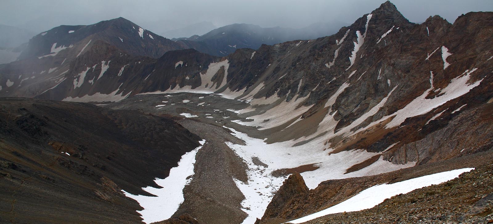
Alamkooh is a mountain in the Alborz mountain range in the north of Iran, Mazandaran Province, forming a peak of the Takht-e Suleyman Massif.
Alamkooh is a mountain in the Alborz mountain range in the north of Iran, Mazandaran Province, forming a peak of the Takht-e Suleyman Massif. It is located in the Kelardasht District of the Mazandaran Province of Iran. With an elevation of 4,848 meters, it is the second highest peak in Iran behind Mount Damavand.
Alam Kooh is sometimes been written as: "Alamkouh", "Alamkoh", "Alamkuh", "Alamkooh" or "Alam kouh". Alam means some sort of object standing straight like a flag and Kooh means mountain. Geological map of Iran it shows that Alam Kooh is mainly made of tertiary intrusive rocks; granite and diorite. Some Triassic and Jurassic sediments are also found. Alamkooh is exactly like tiger wall in Alps. Alam kuh’s common areas are well known and its alias name is Iran’s Switzerland, including Kelar Dasht & Sarab Rood. It is rich in wildlife as well.
- The north face (a little toward north-west) is actually a giant vertical wall. This wall and impression of climbing it, is what makes Alamkooh famous and demanded for Iranian climbers, these are some correct details about the wall:
There is a glacier names "Alamchal" at the base of the north face that slightly rises up to about 4200m. Then there is about 150m~200m very steep glacier (nearly vertical). And the wall rises up about 450m vertical granite rock up to the summit!
The 800 m high, steep granite north face provides some of the most difficult and interesting mountaineering routes in the country and the climbs rank alongside major climbing routes in the European Alps. In addition to local climbers, the north face attracts European climbing teams.
Alam Kooh is the tallest needle located at the heart of Takht-e-Soleiman massif, actually at the joint point of the following ridgelines:
1 East ridge -> Shakhak peaks -Siahsang(4604m) - Chaloun(4516m) - Siahkaman(4472m)
2 South west ridge -> Khersan peaks - Gardoonkooh(4402m) / Haftkhans
3 North ridge -> Germans flank - Shanehkooh(4485m) - Takht-e-Soleiman(4669m) - S Siahgoog(4446m)...
Surrounded by: - Alamchal glacier from north
- Split glacier from west
- Khersan glacier from south between Alam Kooh, Khersan andMarjikesh
- Marjikesh glacier from south between Marjikesh and Siahsang
The upper portion of Alam Kooh is made of a one km (0.6 mile) long east-west running ridgeline that is entirely above 4700 m (15420 ft). The summit of Alam Kooh is a gigantic rocky block that occupies the western one quarter of the ridgeline. To the east of it, there are other high points, some of which can be thought of as individual peaks in their own rights. These are known as the “Shakhaks” (Horns) of Alam Kooh.
Climbing Alam Kooh via all north routes are class five high altitude technical climbs which need hard struggling with rock, ice and rock falls but the southern slopes of Alam Kooh and the Shakhaks are steep covered with boulders and/or scree and they form Khersan and Marjikesh glaciers. The southern routes are easy class three climbs at summer. Anyway climbing Alam Kooh by any route at winter is difficult and technical.
If you want something above and beyond the experience of the average climber who comes to this area, you would surely want to climb one of the shakhaks of Alam Kooh. #1 is the closest one to Alam Kooh and can be easily combined with it. Except for the last few hundred meters, the route will be the same. From the great summit of Shakhak #1, you will get a unique view of the north wall of Alam Kooh that is rarely seen by others. You are also guaranteed to have the whole summit to yourself. Unless you plan to do serious technical climbing, you should use the southern slopes to reach the summit of Alam Kooh or its shakhaks. You can, however, approach the southern slopes from either the south or the north. The starting point for both routes is the village of Roodbarak. Both routes usually require three days.
The mountain range supports permanent snow and glaciers. Although the southern slopes of the range tend to be dry and barren, the northern valleys leading to the Caspian Sea (which offer the best approaches to the mountains) are wet and lush with vegetation. June to October is the ideal season. Climbing in winter will obviously be much harder due to extreme cold and heavy snow cover. In summer, the weather is generally clear. Unexpected thunderstorms do occur frequently. Precipitation at higher elevations will almost always be in the form of snow/hail.

